Log in
All resources
Create a design
4,430 Free Artworks of Maps With View Images
maps in the library of congress
plan stolichnago goroda sanktpeterburga c izobrazhenïem znashni︠e︡ĭshikh onago prospektov
mikhail makhaev
maps from the earth and its inhabitants, vol. iv
arnold's geographical handbook (1899)
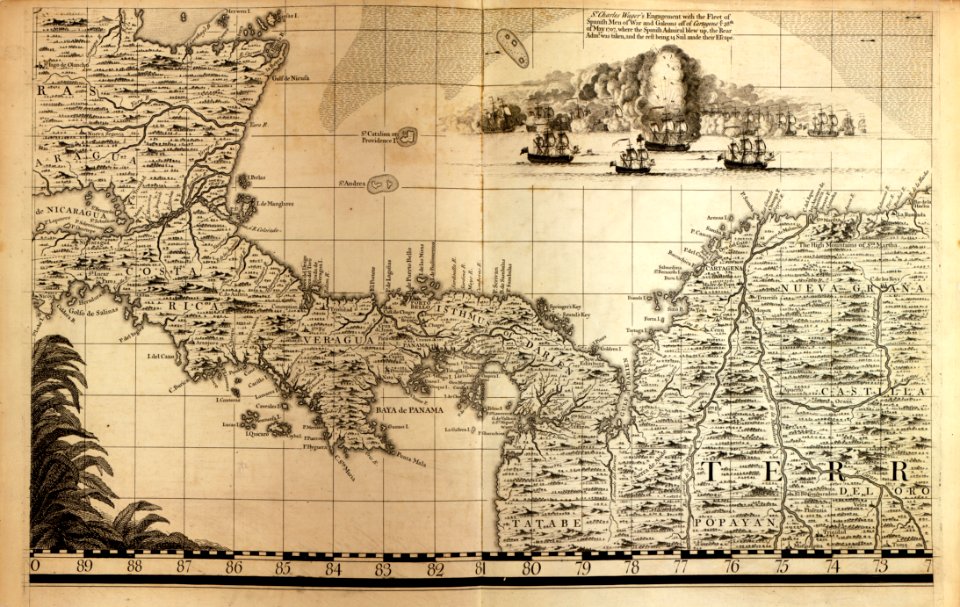
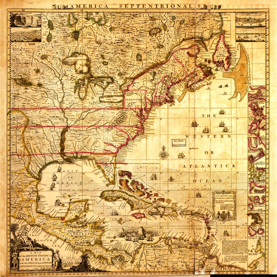
a map of the british empire in america with the french and spanish settlements adjacent thereto
asia noviter delineata
willem blaeu
maps from the earth and its inhabitants, vol. xiii
maps from the earth and its inhabitants, vol. xii
postcards of creek county, oklahoma
curt teich postcard archives
maps from the earth and its inhabitants, vol. vi
charles eugène perron
maps from the earth and its inhabitants, vol. xvii
maps of louisville, kentucky
maps from the earth and its inhabitants, vol. iv
boston, england
herman diederik joan van schevichaven
revolt of the batavi
herman diederik joan van schevichaven
maps of the history of belgium
arnold's geographical handbook (1899)
road maps of the united kingdom
arnold's geographical handbook (1899)
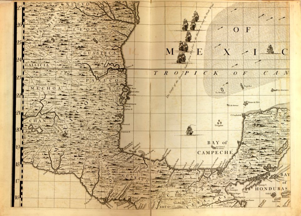
1890s maps of central america
arnold's geographical handbook (1899)
old maps of the amazon river
1890s maps of central america
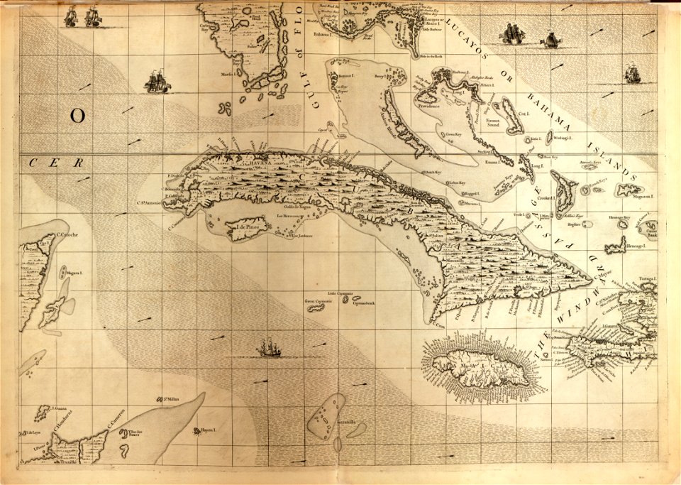
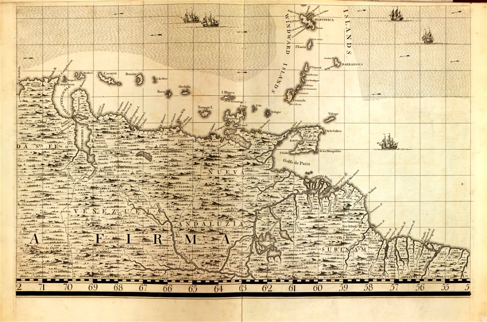
1890s maps of the caribbean
arnold's geographical handbook (1899)
1899 maps of the united states
geological maps of pennsylvania
1885 maps of pennsylvania
19th-century maps of the british isles
arnold's geographical handbook (1899)
old southwark and its people (1878)
16th-century maps of london
asia noviter delineata
1617 drawings
a treatise on ore deposits (1896)
1890s maps of saxony
french-language maps of south africa
1876 maps of africa
1876 maps of north america
1876 maps of the caribbean
1876 maps of the united states
old maps of new england
nouveau cours d'instruction primaire de géographie (1886)
1886 maps of france
with the armies of the balkans and at gallipoli (1880)
battle of gallipoli
shober & carqueville lithographing company
baylor university
a map of the british empire in america with the french and spanish settlements adjacent thereto
maps in the library of congress
maps from the earth and its inhabitants, vol. ix
old maps of the holy land
maps from the earth and its inhabitants, vol. vi
latin-language maps
maps from the earth and its inhabitants, vol. xvii
anton francesco lucini
the cruise of the marchesa (1889)
1880s maps of the philippines
the cruise of the marchesa (1889)
19th-century maps of borneo
corona and coronet (1898)
1898 maps of the world
maps in the library of congress
old maps of antigua and barbuda
historical images of bijapur
bijapur palace
maps in the library of congress
1750s maps of the americas
1890s maps of the caribbean
brethren of the coast
john rocque's 1746 map of london
old and new london (book)
historical images of castle of eger
maps of eger by braun & hogenberg
eran laor cartographic collection
18th-century maps of jerusalem
arnold's geographical handbook (1899)
1899 maps of india
arnold's geographical handbook (1899)
1899 maps of the caribbean
maps from the earth and its inhabitants, vol. ix
maps of telegraph lines
maps from the earth and its inhabitants, vol. iv
maps of portland, england
maps from the earth and its inhabitants, vol. viii
demographic maps of thailand
maps from the earth and its inhabitants, vol. xiii
ethnographic maps of africa
maps from the earth and its inhabitants, vol. vii
maps of xuanzang's travels
old maps of south africa
maps of the great trek
maps from the earth and its inhabitants, vol. iv
maps of loch fyne
maps from the earth and its inhabitants, vol. vii
maps of the yellow river
maps from the earth and its inhabitants, vol. iv
mouth of tay
maps from the earth and its inhabitants, vol. x
19th-century maps of egypt
maps of rivers of senegal
bafing river
maps from the earth and its inhabitants, vol. xi
maps indicating exploration
maps from the earth and its inhabitants, vol. xv
maps indicating exploration
maps from the earth and its inhabitants, vol. xii
maps of icebergs
maps from the earth and its inhabitants, vol. iv
maps of kirkwall
maps of the western cape
breede river
arnold's geographical handbook (1899)
1890s maps of new zealand
arnold's geographical handbook (1899)
maps of the panama canal
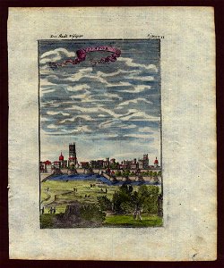
historical images of vienna
schottenkirche, vienna
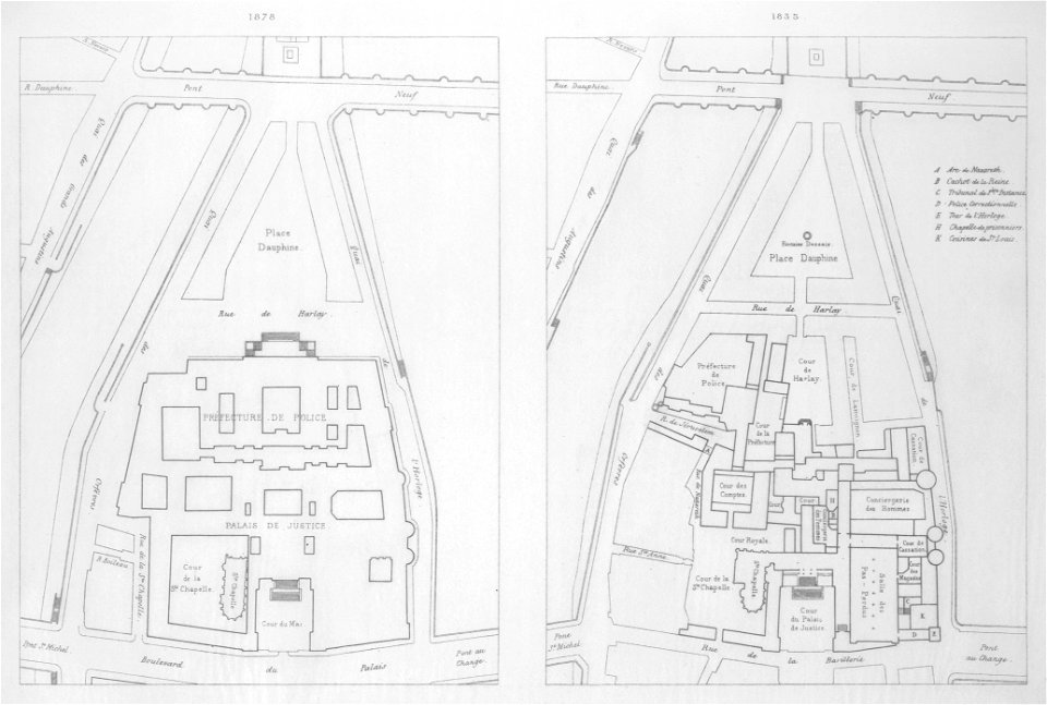
paris à travers les âges
lithographs of paris
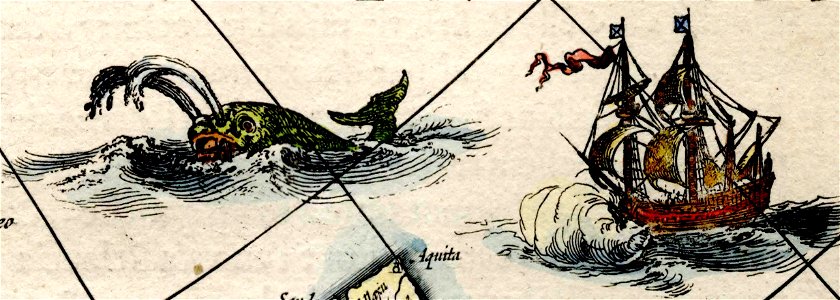
asia noviter delineata
1617 drawings
asia noviter delineata
muscovy
asia noviter delineata
sumatra in art
maps from the earth and its inhabitants, vol. iv
topographic maps of the united kingdom
maps from the earth and its inhabitants, vol. xv
19th-century maps of british columbia
maps from the earth and its inhabitants, vol. xiii
maps of weather and climate of south africa
old maps of la gomera
1878 maps of spain
maps from the earth and its inhabitants, vol. xii
19th-century maps of senegal
maps from the earth and its inhabitants, vol. iv
topographic maps of ireland
maps from the earth and its inhabitants, vol. xv
19th-century maps of british columbia
maps from the earth and its inhabitants, vol. xiv
1870s maps of new zealand
maps from the earth and its inhabitants, vol. iv
old maps of the lake district
maps of assen
paterswolde
our arctic province, alaska and the seal islands (1886)
old maps of alaska
maps from the earth and its inhabitants, vol. iv
old maps of the lake district
the comprehensive history of england (1876)
english-language maps showing history
nouvelle géographie universelle, vol. viii
1876 maps of india
maps of pangong tso
old maps of ladakh
giovanni battista rossi
1890s maps of yemen
maps from the earth and its inhabitants, vol. iv
maps of glenmore
the cruise of the marchesa (1889)
19th-century maps of new guinea
postcards of motels in california
curt teich postcard archives
plan stolichnago goroda sanktpeterburga c izobrazhenïem znashni︠e︡ĭshikh onago prospektov
maps in the library of congress
plan stolichnago goroda sanktpeterburga c izobrazhenïem znashni︠e︡ĭshikh onago prospektov
maps in the library of congress
plan stolichnago goroda sanktpeterburga c izobrazhenïem znashni︠e︡ĭshikh onago prospektov
maps in the library of congress
plan stolichnago goroda sanktpeterburga c izobrazhenïem znashni︠e︡ĭshikh onago prospektov
maps in the library of congress
plan stolichnago goroda sanktpeterburga c izobrazhenïem znashni︠e︡ĭshikh onago prospektov
maps in the library of congress
plan stolichnago goroda sanktpeterburga c izobrazhenïem znashni︠e︡ĭshikh onago prospektov
maps in the library of congress
plan stolichnago goroda sanktpeterburga c izobrazhenïem znashni︠e︡ĭshikh onago prospektov
maps in the library of congress
plan stolichnago goroda sanktpeterburga c izobrazhenïem znashni︠e︡ĭshikh onago prospektov
maps in the library of congress
plan stolichnago goroda sanktpeterburga c izobrazhenïem znashni︠e︡ĭshikh onago prospektov
maps in the library of congress
plan stolichnago goroda sanktpeterburga c izobrazhenïem znashni︠e︡ĭshikh onago prospektov
maps in the library of congress
plan stolichnago goroda sanktpeterburga c izobrazhenïem znashni︠e︡ĭshikh onago prospektov
maps in the library of congress
plan stolichnago goroda sanktpeterburga c izobrazhenïem znashni︠e︡ĭshikh onago prospektov
maps in the library of congress
the comprehensive history of england (1876)
english-language maps showing history
a map of the british empire in america with the french and spanish settlements adjacent thereto
maps in the library of congress
a map of the british empire in america with the french and spanish settlements adjacent thereto
maps in the library of congress
a map of the british empire in america with the french and spanish settlements adjacent thereto
maps in the library of congress
a map of the british empire in america with the french and spanish settlements adjacent thereto
maps in the library of congress
a map of the british empire in america with the french and spanish settlements adjacent thereto
maps in the library of congress
books published in saint petersburg
boris andreevich dorn
historical images of tortosa
history of tortosa
601 - 700 of 4,430
Next page
/ 45